Research project: Satellite image processing techniques for effective management of land use and irrigation demand in the Aral basin - INTAS Aral
A project funded by the INTAS Programme
A project funded by the INTAS Programme
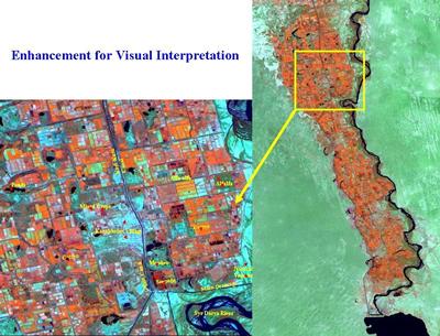
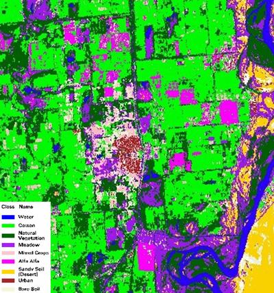
An algorithm has been developed which is able to identify crops in farmers' fields in the Aral basin with an accuracy of over 95%. B This allows irrigation managers to identify when crops are planted and harvested and the area of each, information that is essential for effective irrigation scheduling.
The new Sensible Heat Balance method for calculating evapotranspiration from satellite data has been shown to give results that are remarkably close to evapotranspiration rates measured from the ground truthing programme. It takes into account wide variability in crop development and weed cover. Although in the literature the method is reported as giving most accurate estimates of evapotranspiration on large areas only, in the large irrigation massifs of Central Asia it has proved remarkably effective in identifying intra and inter-field variation in evapotranspiration. The variation observed was found to be in close agreement with variations in soil moisture content and irrigation practices observed in the experimental fields.
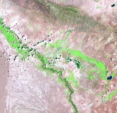
The use of GIS in managing both the evaporation rates data from satellite images and topographic and irrigation map data proved very effective. The GIS was able to identify the amount of water used by the whole project, by secondary canal command areas and individual fields. In combination with data from canal discharges it was used to calculate irrigation efficiencies and also to establish the amount of irrigation water wasted from abandoned fields and waste ground.
The potential impact of the research on effective water management of scarce water resources is very high. Irrigation accounts for over 95% of the consumptive use of the world’s resources. Water use efficiency within these projects is known to be extremely low, however. In the current research the results indicated that irrigation efficiency in one of the projects studied was as low as 35%. The new methodology provides the ability to identify who is using water, how much they are using and where water is being wasted within whole irrigation massifs and whole catchments. It therefore provides a very powerful tool for improving water resource management. The development of this approach into a full working practical tool for managing the water resources of the Syr Darya river is being continued in a 6th Framework INCO project awarded partly on the basis of the current work.
School of Civil Engineering & the Environment, University of Southampton, UK (Soton)
Soils and Irrigation Unit, Agri-Research Service, Spain (SIU-ARS)
Kazakh Scientific Research Institute for Water Management KazNIIVK
Kazakh Institute for Design of Water Management Structures (KazGIPROVODKHOZ)
Pre-Aral Scientific Research Institute for Agroecology and Agriculture (PNIIASH)
BG Chair of Environmental Technology, AIPET, Kazakhstan
Kazakh Scientific Research Institute for Monitoring Environment and Climate (KazNIIMOSK)