Science for Society: new developments in physical geography
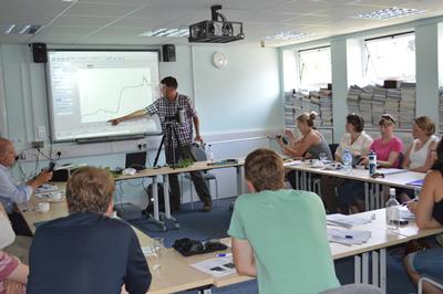
Physical Geographers at the University of Southampton will be sharing their expertise with geography school teachers at a special free course running this week (July 21 – 26).
Southampton's physical geographers are currently engaged in addressing key global geographical questions using a variety of innovative and cutting-edge research techniques. Recent advances place them in a unique position to answer many of the world's problems such as:
- How rivers work at a range of scales
- The impact of water resources on surrounding ecosystems
- How climate change can affect carbon budgets from soils, lakes and other sedimentary archives
- How environmental change influences landscape evolution and can affect ecosystem services
They will be imparting their expertise, experiences and innovation to provide the school teachers with the skills and resources to appreciate leading-edge advances in geography, allowing them to pass on that knowledge, enthusiasm and expertise to a new generation of geographers in schools.
This course aims to:
- Provide teachers with the opportunity to gain hands-on experience with the latest tools and techniques for data collection in the field, and its analysis and interpretation.
- Give teachers an insight into how The Met Office and Ordnance Survey each collect and enhance geographical data to underpin complex forecasting and decision-making.
- Ensure teachers return to school equipped with knowledge of new tools that can contribute to raising standards of geography teaching in their school.
- Allow delegates to engage with leading academics to inspire them to raise the aspirations of their A level geography students, and provide encouragement to those who are considering a BSc in Geography at university.
- Provide an outstanding Continuing Professional Development (CPD) opportunity. This course provides 10 points towards the 35 annual points required for Chartered Geographers.
The course is a collaboration between Ordnance Survey and Southampton University, in association with The Goldsmith's Company and Met Office.
Ordnance Survey
Ordnance Survey is Great Britain's national mapping agency. It collects, maintains and distributes accurate and up-to-date geographic information (GI) which is used by government, business and individuals to underpin a wide range of social and economic activities. A well recognised brand for paper maps, digital data now accounts for 90% of the business. In 2011 Ordnance Survey moved to a new purpose-built sustainable head office building at one of the gateways of Southampton, its home city since 1841.
The University of Southampton
The University of Southampton is one of the UK's leading university geography departments. It is a leading centre of geographical research, both nationally and internationally, with excellent facilities, a strong publication record, and a thriving research culture. In the recent RAE 2008 assessment almost all research activity was judged of international standing, with 20% classed as world-leading.
The Goldsmith's Company
The Worshipful Company of Goldsmiths, more commonly known as the Goldsmith's Company, is one of the Twelve Great Livery Companies of the City of London and received its first royal charter in 1327. In addition to its responsibility for testing the quality of precious metals and its role in supporting the craft and industry, the Goldsmith's Company supports a wide range of charitable and educational projects including the Science for Society courses which aim to inform and inspire teachers of science.
Met Office
The Met Office is the UK's national weather service providing a range of information including weather forecasts, extreme weather warnings, weather and climate predictions and international services. A range of solutions are provided for the public, government, the armed forces, health service and a range of industry sectors including the media, transport, utilities and financial services.
Speakers will include:
Dr Ellie Biggs
Ellie's research interests mainly encompass the spatial and temporal analysis of environmental data, predominantly within the field of hydroclimatology. Her research is currently focussing on the adaptation and sustainability of rural communities to climate-induced environmental change.
Professor Steve Darby
Steve's research interests include morphodynamics of large monsoon-affected rivers and submarine meanders, modelling river channel dynamics and floodplain processes in meandering rivers and forested floodplain environments, and landscape evolution modelling investigating the influence of vegetation on fluvial forms and processes.
Dr Gareth Roberts
Gareth's research interests focus on monitoring land surface dynamics using optical and thermal remote sensing. One aspect of this concerns linking Earth Observation (EO) data with models for quantifying land surface dynamics and vegetation change using biophysical parameters such as leaf area index and vegetation cover.
Dr Chris Hackney
Chris' research interests include fluvial dynamics, landscape evolution modelling and coastal geomorphology. He is currently working on modelling sediment transport and erosion in large alluvial rivers.
Follow live news from the event on twitter with #geogsotonS4S
To learn more about the event itself and for contact information please click here.
Links to external websites
The University cannot accept responsibility for external websites.