From Iceland to Botswana – examining complex surface terrain
Research funded by the Royal Society, the Natural Environment Research Council and the Worldwide Universities Network is exploring estimating aerodynamic roughness using surface terrain measurements of sandar (glacial outwash plains) in Iceland and salt pans (dry lakes) in Botswana.
From a five day boat journey to the midnight sun of Iceland, to the vast expanse of a white, salty moonscape in the wilds of African Botswana, a sandur and a salt pan may seem like an unlikely coupling however, their complex, small scale roughness, relative flatness, lack of vegetation and large fetch make them the ideal experimental surfaces to develop empirical estimations of aerodynamic roughness from terrestrial laser scanner (TLS) datasets. More importantly, sandar and salt pans are also both potential dust emission sources, and so improving our understanding of surface-atmosphere interactions over surfaces in these areas is vital.
In a new paper just out in Journal of Geophysical Research - Atmospheres, Dr Jo Nield, together with colleagues from Oxford (Giles Wiggs, James King, David Thomas, Richard Washington), Southampton (Julian Leyland, Steve Darby, Larisa Vircavs), Liverpool (Richard Chiverrell), Cape Town (Frank Eckardt) and Sheffield (Robert Bryant) investigated 20 surfaces with element heights ranging from 1 to 199mm during four field campaigns. Co-located anemometer towers at each location measured actual aerodynamic roughness to compare to a myriad of surface metrics derived from TLS datasets.
Using cluster analysis height, shape, spacing and variability metric groups were compared to decipher which best estimated aerodynamic roughness. When height metrics were employed, it was found that over 90% of the variability was explained and height is a better predictor than both shape and spacing.
This finding is in juxtaposition to wind erosion models that assume the spacing of larger-scale isolated roughness elements is most important in determining aerodynamic roughness. The study recognizes that when small-scale surface roughness is accurately quantified (with millimetre accuracy using TLS), height is most significance for estimating aerodynamic roughness, irrespective of comparator metric choice. This has very significant implications for the development of aerodynamic roughness predictors which are fundamental to the efficiency of wind erosion models, and, particularly, dust emission schemes in climate models.
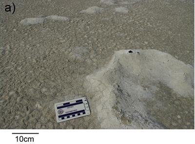
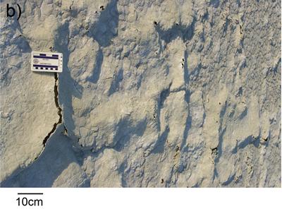
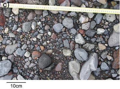
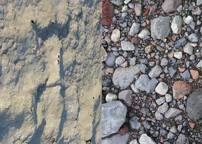
The visuals below show (a) irregular salt pan, (b) regular, polygonal salt pan, and (c) sandur surface patterns measured using the TLS.
This research was undertaken thanks to many collaborative hours in the field with the Iceland data collection funded by the Royal Society and the Botswana work part of DO4Models, a much larger NERC funded project, with some travel support from the Worldwide Universities Network.
Nield, J.M., King, J., Wiggs, G.F.S., Leyland, J., Bryant, R.G., Chiverrell, R.C., Darby, S.E., Eckardt, F.D., Thomas, D.S.G., Vircavs, L.H., Washington, R.: (2013) Estimating aerodynamic roughness over complex surface terrain. Journal of Geophysical Research - Atmospheres, 118, 12,948-12,961, doi: 10.1002/2013JD020632.2013