New programme produces virtual alternative to field studies
The University of Southampton has developed a new technology-enhanced fieldwork visualisation programme to maximise the productivity of students’ time in the field.
The new programme produces a virtual alternative and supplement to field studies applicable to the University’s Earth Science degrees.
The primary aim is to provide fundamental fieldwork experience for students with mobility impairments who cannot access some field areas and students requiring additional time in the field or who would benefit from accessing the field virtually when back on campus.
Beyond increasing the accessibility of fieldwork, a further aim is to provide a laboratory-based learning tool which integrates field observation, data recording and hands-on sample investigation.
Dr Rex Taylor, Senior Lecturer in Ocean and Erath Science at the University, who developed the programme says:
“Field studies are an expensive component, both in time and resources, in Earth Science degrees. It is therefore essential to extract the greatest possible educational value from field activities. All students, regardless of physical ability, would benefit from being able to revisit the field experience after a trip. As such, it is logical that a detailed visual and material record of each field course would be a valuable resource with which to reinforce skills, research or revise when back on campus. Conversely, some fieldwork skills could be primed by examining localities or sites prior to the trip, enabling students to more rapidly absorb information in the field.
“Investment in technology-driven alternatives will enhance science teaching at Southampton and ensure that our students learning experience is maximised.”
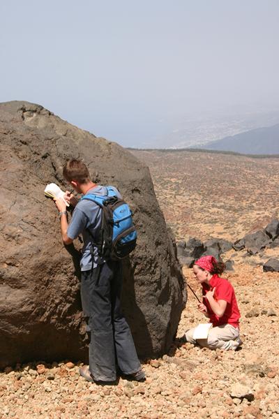
Current field study methods start by examining the locality from an overall or wide perspective to develop a view of the overall structure and can produce questions about particular features. Next, a detailed examination of the material, mineralogy or rock type forming the exposure can be made using hand specimens and a hand lens or other magnifying tool.
In the new laboratory-based field visualisation Dr Taylor is proposing, the starting point would be an aerial photograph or a Google Earth image. Selecting a locality within such an image would then bring up an overall view of the exposure in the form of a GigaPan® photo-mosaic. GigaPan is a system for capturing a large array of high-resolution photographs from a particular scene. These photographs can then be “stitched” together by proprietary software to form a continuous overview image.
Selecting any point of interest or scrolling-in to this overview reveals successively higher resolution images with increasing levels of visible detail. As the higher levels of zoom are activated, particular features which have further levels of magnification become highlighted. Selecting these in turn reveals a close-up image, also incorporating the multimedia possibilities of tools such as Sketchup that provide a sense of volume and space. It is at this level that the visualisation can be blended with a hands-on experience. Selectable labels on the close-up image direct the user to samples/specimens/artefacts from this feature that are available in a tray or compartment adjacent to the workstations, and to digital equivalents produced through laser scanning or other methods.
The final level of magnification is achieved by viewing a microscope slide made from the sample, either virtually as an image, or directly on a microscope also provided next to the workstation.
Related Staff Member
Investment in technology-driven alternatives will enhance science teaching at Southampton and ensure that our students learning experience is maximised.”