Staff at COARS have worked on a large number of offshore and coastal infrastructure projects, providing advice, assessment and analysis programs to suite their clients needs.
Key projects include:
Work has also been undertaken on a range of other projects including:
- Coots Ltd Pipeline for Carbon Capture Storage (CCS) delivery
- BritNed Interconnector Power Cable
- GLO-1 Submarine fibre optic cable
- High Speed 2 Archaeological Specifications
- Sizewell C Power Station
- Tees Exploratory Well

Outer Thames Regional Environmental Characterisation
Staff at COARS, in conjunction with EMU, undertook a geological and heritage assessment of the Outer Thames Estuary, as part of an MALSF-MEPF Regional Environmental Characterisation project, revealing c. 15,000 km 2 of submerged landscapes. After compilation and interpretation of new and legacy seismic data, targeted borehole collection was undertaken. The collected material permitted the establishment of the chronology of different areas of this landscape by using several dating techniques including palaeo-secular variation (PSV), amino acid racemization (AAR), electron spin resonance (ESR), optically stimulated luminescence (OSL) and radiocarbon dating ( 14 C). The resultant chronologies demonstrated that many of the observed sedimentary sequences were Late Glacial to Middle Holocene (c. 20,000-7000 years ago) in date. Earlier river channel activity across the study area was found to date from the Middle to Late Pleistocene (c. 160,000 – 70,000 years ago), while a restricted number of sites were identified, both morphologically and chronologically, dating back to the Early to Middle Pleistocene (significantly older than 420,000 years ago). The exceptional level of preservation revealed from the area studied demonstrates great potential for:
- understanding our earliest archaeological heritage;
- understanding the broader geological changes which have occurred during several episodes of sea level and climate change; and
- provide an enhanced context for a number of aggregate licensing areas and other commercial seabed projects in the wider area.
Click here for a link to the project report .
Commissioned by the The Marine Aggregate Levy Sustainability Fund

Hinkley Point C Power Station
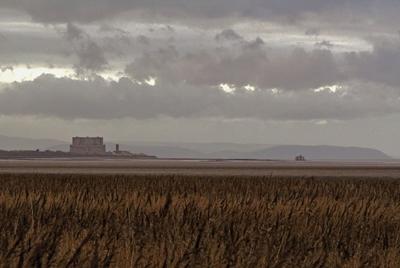
As part of the planning consent process, staff at COARS undertook an integrated geophysical, geotechnical and archaeological survey for the offshore component of the proposed development of the Hinkley Point C power station on the southern edge of the Bristol Channel, UK. In addition to assessing the offshore archaeological resource (eg. wrecks), geotechnical boreholes and marine geophysics were used to understand the geological composition of the offshore area, revealing extensive peat deposits c. 15m below OD, dating from c. 9000 years ago. These were investigated as part of the mitigation process and have yielded vital information about the past landscape, human activity and sea level change. The geophysical survey data has provided an unrivalled picture of the submerged landscape below the Bristol Channel. Results of these investigations are in the process of being published as a series of journal articles and reports.
Commissioned by AMEC on behalf of EDF Energy

London Array Offshore Windfarm
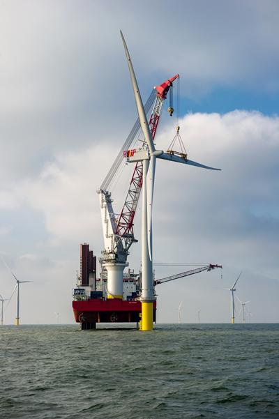
Staff at COARS, in conjunction with Ramboll UK, acted as the retained archaeological consultants during the construction of the London Array offshore windfarm, the largest commissioned in the world. The project was two-pronged with an overall assessment of all archaeological assets within the scheme alongside detailed assessments on each seabed installation. The latter was part of an iterative process permitting rapid identification of any affected heritage assets during the array layout design and ongoing logistic works, thus permitting modifications to be made where necessary. Post-installation survey data is currently being inspected to identify any resultant effects of sea bed scour upon both the sea bed and previously identified assets such as wrecks.