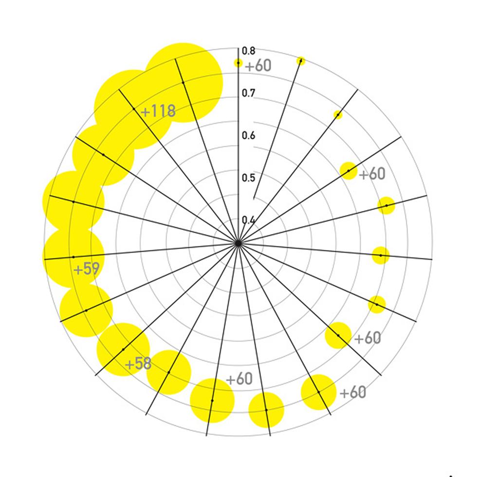
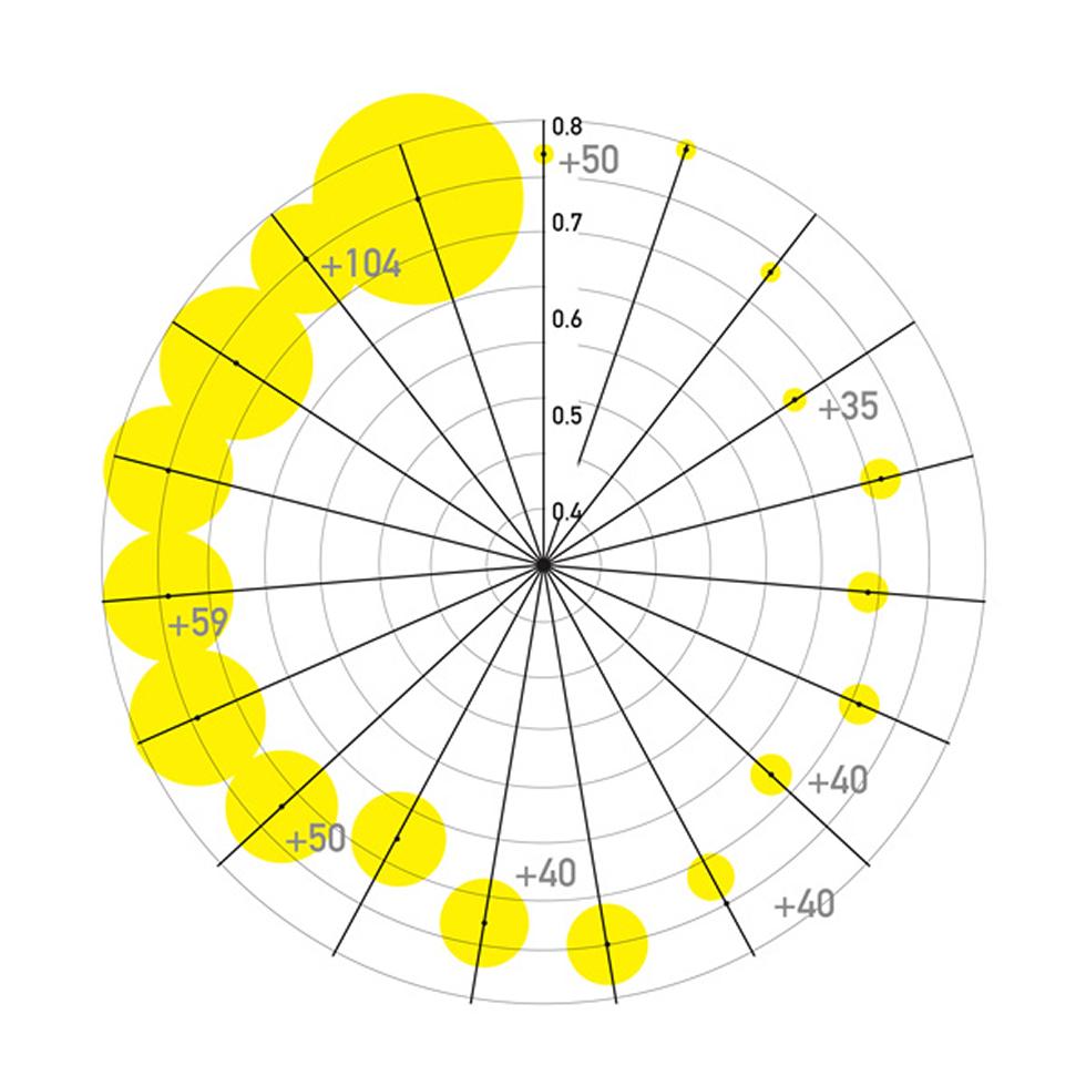
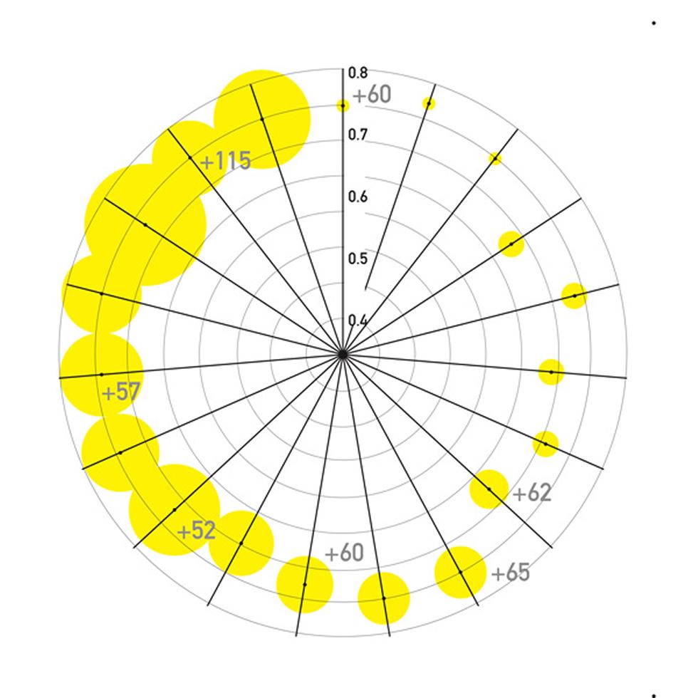
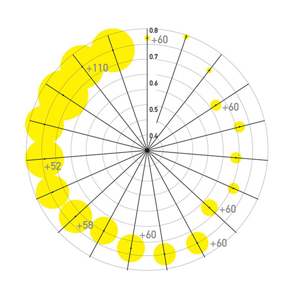
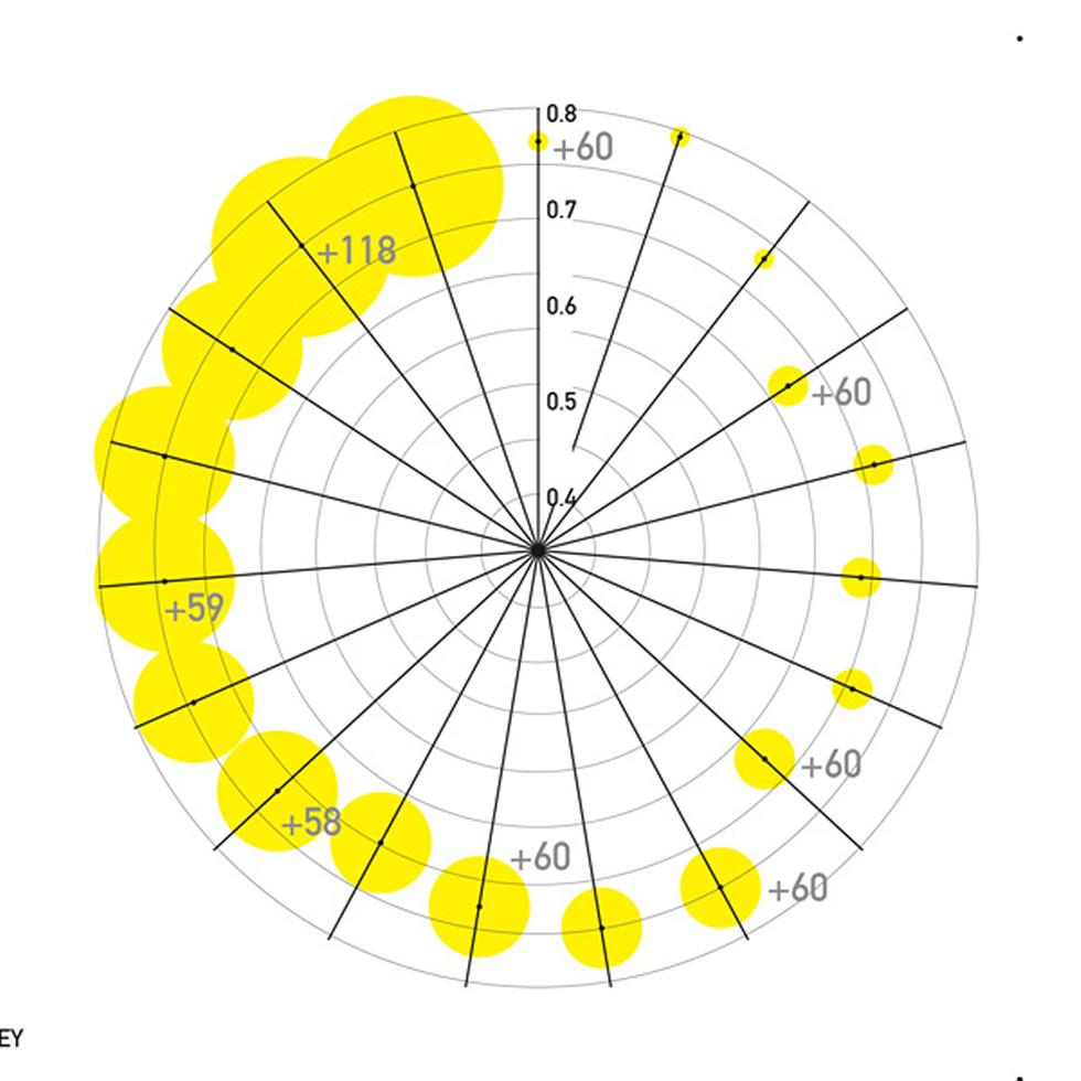
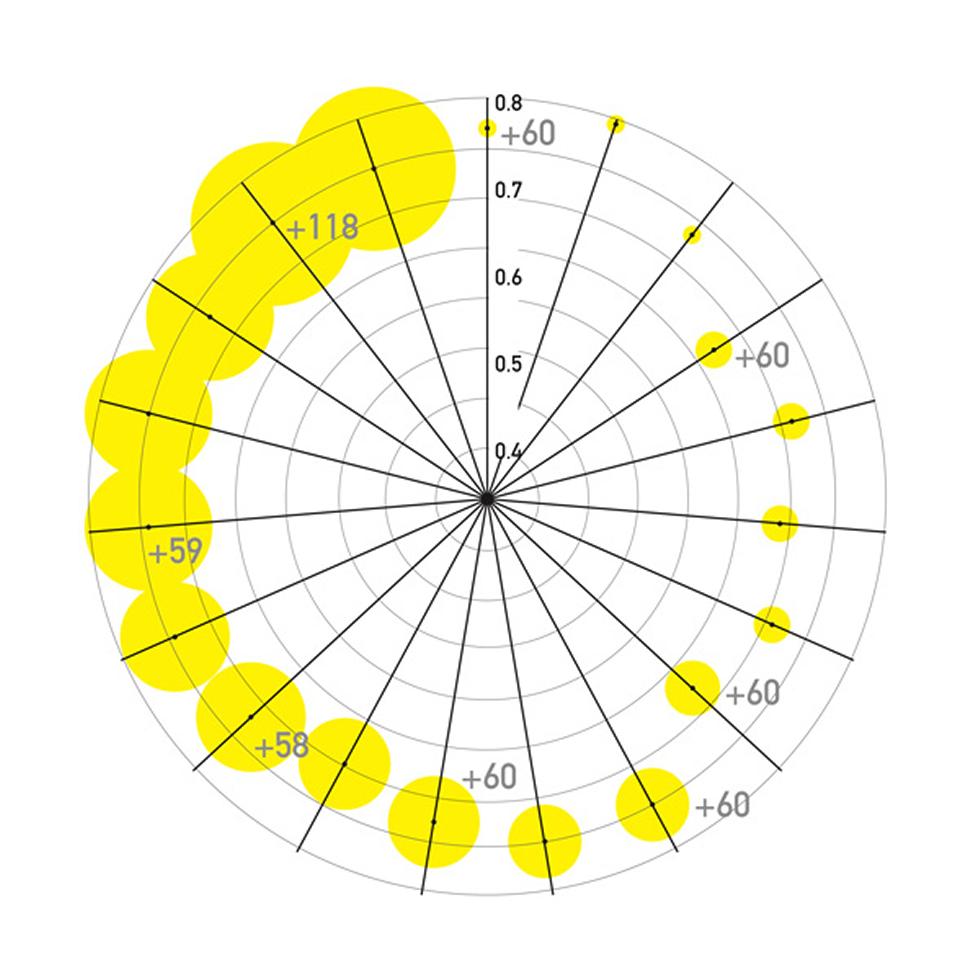
A project to map accumulations of orbital debris
Visualisations show the number of STARLINK satellites in earth's orbit and the likelihood of collision.
SOCRATES 31052020 STARLINK --1 KM
Black dot represents average minimum miss distance (km), 0.1 = 0.1km
Yellow circle represents number of STARLINK satellites in orbit