Drone Assisted Environment Sensor Network successfully deployed on glacier
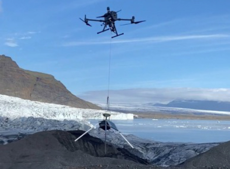
The School’ Glacsweb team, PI’s Professor Jane K Hart (Geography and Environmental Science) and Prof Kirk Martinez (School of Electronics and Computer Science), with Dr Nathaniel Baurley, Amelia Andrews, Dr Graeme Bragg, Sherif Atta and Michael Jones, have succeeded in deploying a unique drone assisted sensor to measure glacier motion, as part of a Leverhulme grant to investigate the response of glaciers to climate change.
The team designed and built a low cost positioning system (GNSS) which collects data and sends it directly to the glacsweb.org website. For the first time, the team created a lighter version, which could be airlifted on to the glacier via a drone. These ‘mobile’ sensors were lowered onto two Icelandic glaciers (both 1.5 km away), and send their data back daily. The team are using drones to enable the deployment (and collection) of data in locations which would be impossible to access manually.
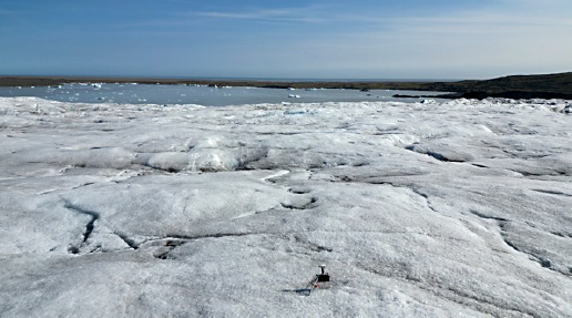
Professor Jane K Hart, PI on the study from the School of Geography and Environmental Science comments, “The aim of Glacsweb project is to further the study of how glaciers move, in order to understand glacier retreat and its contribution to sea level rise. In association with the sensor network we were able to use drones to make daily surveys of the changing glacier behaviour, lake level changes, calving behaviour and glacier velocity.”