Key paper on braided rivers selected as 'Journal Highlight'

A recent paper published by an international team of researchers that includes Professors David Sear and Steve Darby from Southampton University’s Geography and Environment Earth Surface Dynamics research group, has been profiled as a “Journal Highlight” by the American Geophysical Union.
The paper has just been published in the Journal of Geophysical Research-Earth Surface, is lead authored by former Southampton PhD student Joe Wheaton (now of Utah State University), and is entitled ‘Morphodynamic signatures of braiding mechanisms as expressed through change in sediment storage in a gravel-bed river'. It is novel in presenting the very first high resolution field test of the causal mechanisms for maintaining braided rivers.
Braided rivers with their continuously changing network of channels are highly dynamic systems that support a diverse ecology. They dominate the geological record prior to the development of plants, and are characteristic of environments with high rates of sediment production and frequent sediment transporting flows. In the new paper, the team used high resolution repeat topographic survey analysis to link the mechanisms creating braiding to the volumes of sediment stored (or lost) within the river channel. The findings confirm the importance of key mechanisms of braiding, but also highlight the role of bank and bed erosion as the source of the sediment used to drive these mechanisms.
The paper also demonstrates the importance of water flow in maintaining the braided river pattern, revealing that the dominance of the different braiding mechanisms change as the water moves from flow within confined channels to flow over the bars and floodplain surface. The latter has important implications for natural resource practices that modify stream flows and sediment fluxes such as hydropower, and for changes in runoff arising from climate change or land use modification.
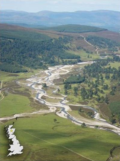
The braided River Feshie, Scotland (pictured) exhibits multiple channels and large areas of exposed gravel sediments. Repeat topographic surveys are subtracted to reveal the patterns of erosion and deposition over time. Understanding these helps scientists to explain how rivers braid, and therefore how the patchwork of unique river habitats is maintained.
Click here to see the article on the American Geophysical Union website.