University teams up with Ordnance Survey to accelerate geospatial innovation
Two of the UK’s leading geospatial institutions, the University of Southampton and Ordnance Survey (OS), have joined forces to ensure the UK stays ahead of the curve in revolutionising location data and technologies, in support of the UK Geospatial Strategy 2030.
Combining their strengths in world-leading mapping and innovative data technologies, the new partnership will enable knowledge sharing and cutting-edge geospatial research such as the application of artificial intelligence to drive greater insights from location data.
Geospatial refers to using location and mapping data to measure and model objects or events on Earth. This can be anything from buildings, to glaciers, to populations.
Representatives from the university and OS signed an official Memorandum of Understanding to formalise their collaboration on Wednesday 17 January. The event was attended by Sarah Hodgetts, Director at the UK government’s Geospatial Commission.
Jadu Dash, Professor of Remote Sensing and Director of the Southampton Geospatial research centre at the university, said: “This new agreement will formalise how we work together, supporting the exchange of scientific, academic and technical information that will help us collaborate on research and innovation opportunities. Jointly, we will work on addressing objectives in the UK Geospatial Strategy 2030.”
For example, in August 2023 the Geospatial Commission published a report on how location data can support the rollout of electric vehicle charge point locations. To align with that, Southampton Geospatial is undertaking a pilot project at the university called CoiL (Charging point Locations), collaborating with Transport for the South East and using OS data to identify optimal locations for the electric vehicle charging infrastructure.
David Henderson, Chief Geospatial Officer at OS, said: “Accelerating the continued development of new geospatial capabilities is a fundamental component of our long-term strategy. Through this partnership, we’re excited to build on a long-standing collaboration with the University of Southampton and to champion the outcomes of our respective world class research and innovation programmes.”
Sarah Hodgetts said: “Collaborations and partnerships are at the core of the UK Geospatial Strategy 2030. I am delighted these two UK geospatial powerhouses are working together to deliver pioneering research to realise the innovative ambitions in the national strategy.”
The university and OS, which is headquartered in Southampton, have an established history of working together on student placements and research. One current project involves researchers from the schools of Electronics and Computer Science, and Geography and Environmental Science, exploring using artificial intelligence to extract information from aerial imagery and satellite data, which could enhance OS data products.
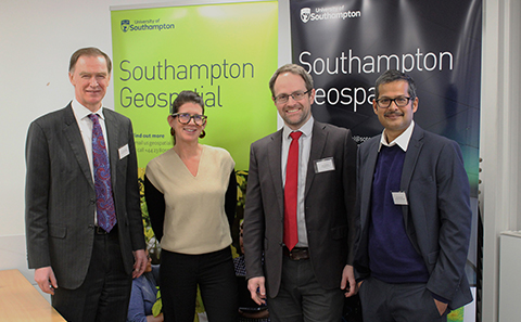
Image caption: From left: Professor Mark Spearing, Vice-President (Research and Enterprise) at the University of Southampton, Sarah Hodgetts, Director at the Geospatial Commission, Matt Goodman, Head of External Affairs at OS, and Professor Jadu Dash, Director of Southampton Geospatial