Southampton’s geospatial research informing seagrass conservation spotlighted in UK Geospatial Strategy 2030
Author: Dr Hachem Kassem
The work of SMMI researchers applying novel geospatial tools to inform seagrass conservation efforts in Studland Bay has been highlighted in the UK Government’s Geospatial Strategy 2030, released 15 June 2023.
The UK Government announced its UK Geospatial Strategy 2030 with the mission to “embrace technologies to accelerate innovation, drive greater use of geospatial applications across the economy, and build confidence in the future geospatial ecosystem”. The strategy aims to ‘unlock significant economic, social and environmental opportunities offered by location data, applications and services to advance the UK’s global geospatial expertise”.
The policy paper spotlights the University of Southampton as “trailblazers in driving research using location data with emerging technologies to bring geospatial data into the forefront of innovation”. The Southampton Geospatial initiative is hailed for bringing interdisciplinary expertise in computer science engineering, geography, mathematical sciences and ocean and earth sciences to drive innovation through independent research and effective partnerships across academia, industry and the public sector to address important societal and environmental challenges.
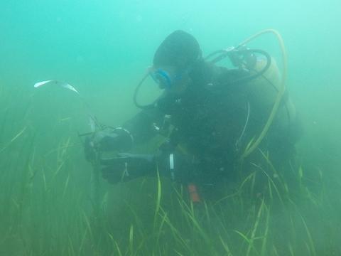
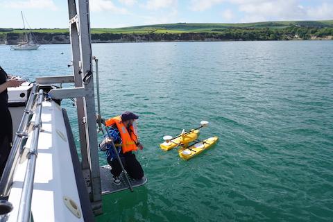
The seagrass mapping project, funded by Southampton Geospatial (led by Dr Hachem Kassem, School of Ocean and Earth Science) and SMMI HEIF knowledge transfer partnership (led by Prof Blair Thornton, School of Engineering, IRIS Centre of Excellence), is applying autonomous surface and underwater vessels (ASV/AUV), diver surveys and machine learning (artificial Intelligence, AI) for automated interpretation of AUV imagery to document the extent and health of seagrass within the Studland Bay Marine Conservation Zone.
This work, in partnership with the Dorset Coastal Forum and the Studland Bay Marine Partnership, has highlighted the advantage of ecomoorings in protecting seagrass meadows against traditional anchoring, and has informed a marine planning application for the next phase of eco-mooring installations within the bay. The Geospatial Strategy 2030 features the project as an example of effective partnerships across academia, industry and the public sector to develop nature-based solutions for coastal protection and habitat conservation in the Studland Bay Marine Conservation Zone.
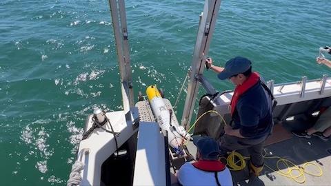
Preliminary results from the surveys were presented in a paper by Dr Miguel Massot-Campos (Senior Research Fellow) at the International Symposium on Underwater Technology (UT23) in Tokyo, Japan and at the Marine Autonomy and Technology Showcase (MATS) at the National oceanography Centre. The data collected were supported the research of MSci student Bronwyn-Walker Rouse, and continue a long-established track record of monitoring the Site, since 1990, led by Dr Ken Collins (Emeritus Fellow within Ocean and Earth Science).
Watch this video to learn more about the Studland Bay Seagrass Survey.