

England’s coastline is continually changing. Beaches, cliffs and estuaries are reshaped by waves, tides, storms, sediment movement and sea-level change. This creates an enduring challenge for those responsible for managing flooding and coastal erosion.
For computer scientist and geospatial data researcher Professor Jason Sadler, one of the answers lies in making the evidence behind those decisions easier to find, combine and interrogate.
Jason specialises in spatial data infrastructure (SDI): the systems and methods through which complex geospatial information can be managed, queried, visualised and reused.
"My work with the National Coastal Monitoring Programme helps turn large volumes of monitoring information into accessible evidence for understanding how the coast is changing."
Professor Jason Sadler
A complicated web of data
Since 2011, coastal monitoring in England has operated through an integrated network of six regional programmes, structured around coastal sediment cells and designed using a risk-based approach tailored to local conditions.
The programme aims both to improve understanding of coastal processes and to provide coastal managers with evidence for sustainable shoreline management and the continuing assessment of flood and erosion risk. That purpose gives Jason's data infrastructure an important role.
"Rather than simply collecting observations, it provides the means to make different forms of coastal evidence usable together," he says.
The infrastructure Jason has helped develop brings together real-time wave, tide and meteorological information with aerial imagery, LiDAR, bathymetry, topography, coastal profiles, habitat, seabed, sediment and point-cloud data - around 500,000 metadata records, 1.4 million files and 12TB of data.
"Open standards, APIs and geospatial technologies allow us to search, visualise, download and reuse these heterogeneous datasets for further analysis. Our data management and delivery system also provides metadata, GIS, real-time data and reporting services for programme partners, public authorities, researchers, commercial users and the public."
Professor Jason Sadler
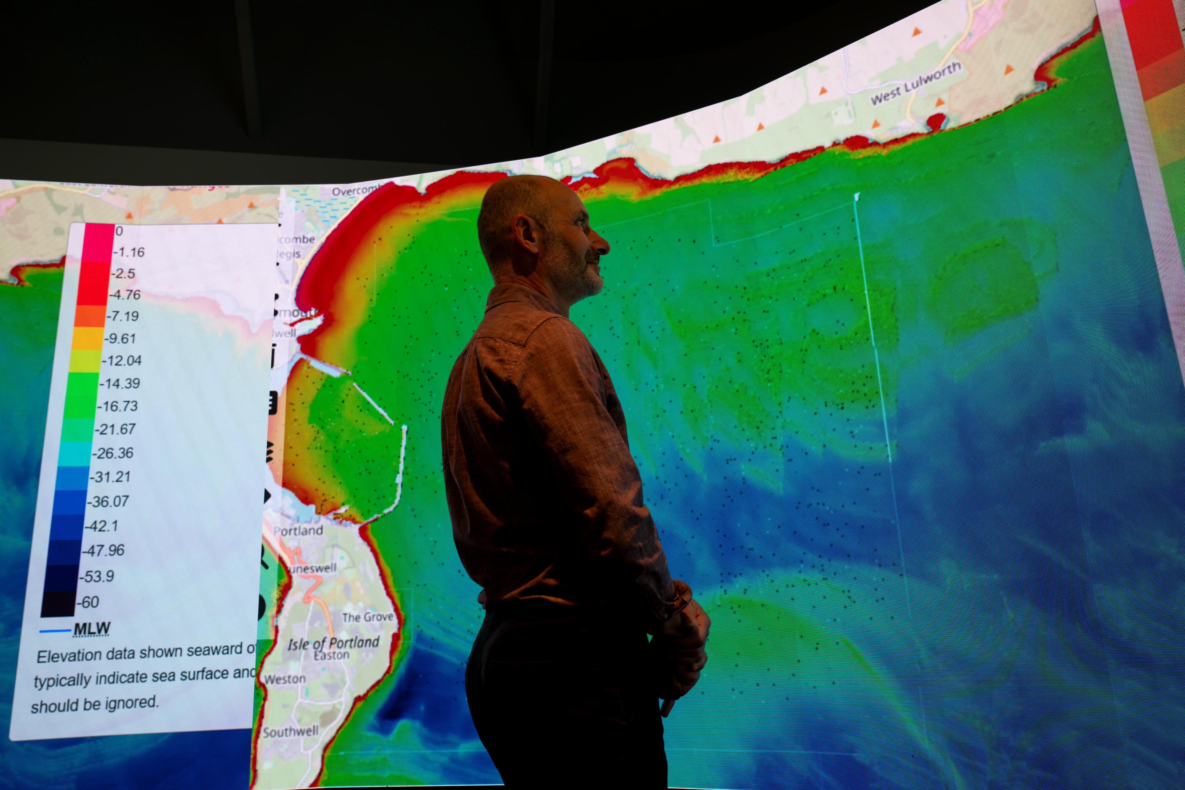
The value becomes clearest when the data informs decisions
Coastal monitoring itself is explicitly designed around risk.
Programme design considers factors, including: exposure to wave attack, coastal flood risk, geomorphology and defence type, shoreline management policy and assets at risk.
Monitoring intensity can then be adapted to local conditions. High-risk beach-management sites, for example, typically receive biannual topographic surveys, while LiDAR is particularly valuable for monitoring rapidly eroding cliffs, dunes and estuarine wetlands.
Real-time information adds another dimension. Wave measurements are collected at heavily managed beaches, high-risk locations and sites where schemes are being developed.
That real-time wave data is transferred to the Environment Agency’s Flood Forecasting Service and the Met Office and has become increasingly important for beach operations and flood warnings.
Technology and human partnership
For Jason, this is where data infrastructure becomes more than a technical exercise.
By establishing the systems through which evidence can be accessed and interrogated, his work helps researchers and coastal managers investigate flooding, erosion and sea-level rise and better understand the processes driving coastal change.
"It is a practical expression of my wider research philosophy: technology has value when it enables people to ask better questions and act on stronger evidence," says Jason.
"For a coastline where today's observations may underpin tomorrow's flood warning, engineering intervention or shoreline strategy, making the data usable is an essential part of making the coast more understandable."



For a coastline where today's observations may underpin tomorrow's flood warning, engineering intervention or shoreline strategy, making the data usable is an essential part of making the coast more understandable.