
About
We work to ensure that everyone is mapped and counted in decision making. We develop geospatial integration methods to make detailed demographic datasets. Our work features in Nature, Science, and the Proceedings of the National Academy of Sciences.
Our datasets are used by governments, international agencies, academia, NGOs and the private sector. We work closely with the United Nation agencies and national statistical offices in low and middle-income countries. Our approaches are designed to maximise uptake and impact, and to strengthen local capacity.
Our work focus areas for development and implementation cover population distributions, demographics and dynamics in resource-poor settings. Our geostatistical modelling integrates data from traditional sources including censuses, and satellite and cellphone datasets.
We produce high resolution maps of:
- age/sex structures
- births
- poverty
- access to services
- vaccination coverage
We also develop modelling frameworks for subnational migration flows, urban change and disease spread.
WorldPop is made up of more than 30 members of staff, including demographers, geographers, ecologists, statisticians, epidemiologists and computer scientists.
Principal funders and collaborators include:
- Gates Foundation
- Foreign, Commonwealth and Development Office (FCDO)
- World Bank
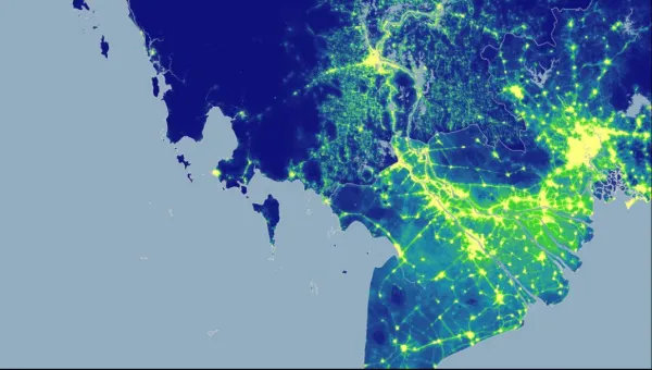
Mapping tomorrow’s population distribution
Research group WorldPop, based at Southampton, is developing maps which can be used to predict the impact of climate change on the distribution of Earth’s population by the end of the century. The maps will provide detailed pictures of humanity by 2100, including predicted population sizes, ages and genders.
-

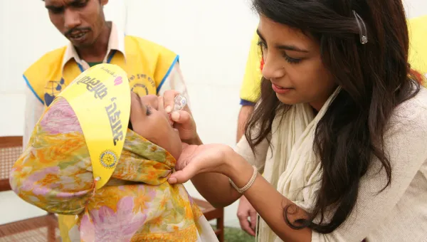
Targeting childhood vaccines globally
WorldPop, a research group led by Professor Andy Tatem, is revolutionising global health efforts by enabling governments to vaccinate children who were previously unreachable.
-
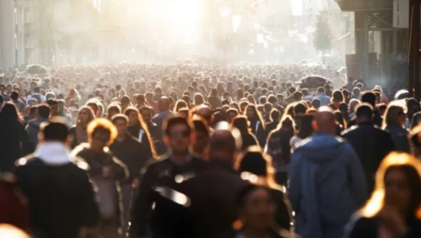
Population mapping saves lives
A University of Southampton research group is using new ways of mapping and counting populations to help developing countries. WorldPop's datasets have helped to eradicate polio in Nigeria and assist earthquake victims in Nepal.
People, projects and publications
People
-

Professor Andrew Tatem
Personal ChairDeveloping approaches to map population distributions, demographics and dynamics throug
Email: A.J.Tatem@soton.ac.uk -

Doctor Assane Gadiaga
Research FellowEmail: A.N.Gadiaga@soton.ac.uk -
Professor Attila Lazar
ProfessorEmail: A.Lazar@soton.ac.ukTel: +44 23 8059 2214 -
Doctor Edson Utazi
Associate ProfessorSpatial and spatiotemporal modelling
Accepting applications from PhD studentsEmail: C.E.Utazi@soton.ac.ukTel: +000 -
Doctor Eimear Cleary
Senior Research FellowEmail: E.Cleary@soton.ac.uk -
Doctor Hal Voepel
Senior Research FellowHydrological and sediment processes in watersheds and rivers
Email: H.E.Voepel@soton.ac.ukTel: +44 7432193404 -
Mr Ian Coady
Deputy Director (Enterprise & Engagement)Email: I.E.Coady@soton.ac.uk -
Doctor Jessica Espey
Associate Professor and Deputy Director (WorldPop)The international governance of sustainable development.
Accepting applications from PhD studentsEmail: J.M.Espey@soton.ac.uk -
Mrs Krishnaveni KS
Senior Research AssistantTel: +44 7562283354


WorldPop complements traditional population data sources with dynamic, high-resolution data from satellites, surveys and cellphones to map human population distributions at high resolution, with the ultimate goal of ensuring that everyone, everywhere is counted in decision making.