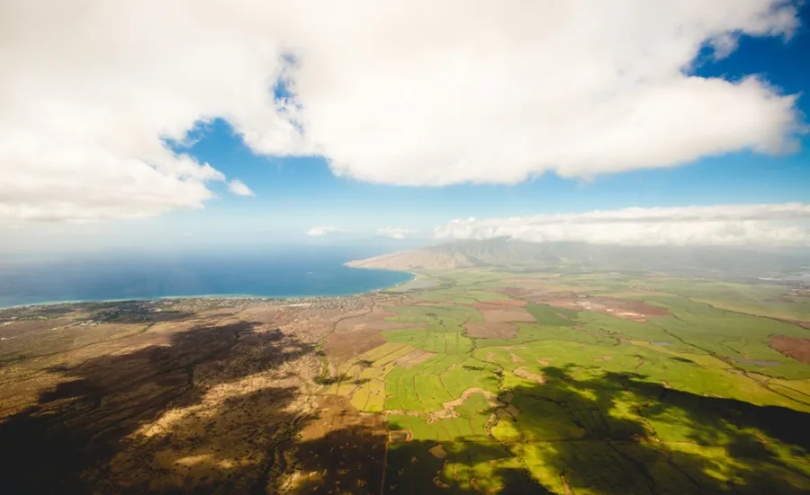
Mathematical sciences academics have teamed up with specialist remote sensing technology provider 2Excel geo to remove the impact of cloud shadows from high-resolution Earth observation imagery.
The project will support 2Excel geo’s development of a new application that will supply detailed airborne data to industries including agriculture, conservation, risk management, ecology, landscape management and water quality.
Earth observation imagery is often accompanied by cloud shadows, which result in data having to be discarded or processed separately. This increases the time and cost of the data analysis exercise that enables the building of accurate predictive models for forestry and environmental monitoring.
Reducing costs and improving quality
Southampton academics will use their expertise in numerical optimisation and quantitative remote sensing to develop a technique that will reliably and accurately remove the impact of cloud shadows from the imagery. This will reduce costs and and improve product quality for 2Excel geo’s customers.
Professor Jörg Fliege, head of operational research within mathematical sciences, said: “2Excel geo was faced with a ‘best guess what’s under the cloud cover’ challenge. Through the SPRINT programme, we’re able to help them with this by offering image analysis, optimisation and high performance computation.
“The University has one of the largest research groups in operational research in the country and our mathematical modelling expertise is a tremendous asset for this project.”
Impact on data analysis
Dr Chloe Barnes, head of remote sensing at 2Excel geo, added: “As a provider of airborne remote sensing services, cloud cover and cloud shadow can be a real challenge. With an average of only 9 days per year when there’s no cloud cover, it can impact our data analysis.
“This SPRINT project has been developed to help us to remove the effects of cloud shadow to enhance our data collection capacity.”
Supporting UK business
Northampton-based 2Excel geo delivers bespoke remote sensing solutions with a focus on forestry, agriculture and the environment.
The work is one of 20 Southampton projects funded by SPRINT, the Space Research and Innovation Network for Technology.
SPRINT is a partnership between 5 top UK space universities, industry, government agencies and the investment community, dedicated to supporting the growth of UK businesses through the commercial exploitation of space data and technologies.


